

This journal follows a solo 3-day Kepler Track hike starting in Te Anau, with practical notes on New Zealand Great Walks like huts, logistics, weather, and what each day feels like on the trail.
Solo Hiking in Fiordland: A 3-Day Journal from the Kepler Track
Ferns blanketed the ground in every direction, and trees rose overhead, making me feel small but safe. It was the third day of my Kepler Track hike, and I found myself moving quickly through the dense forest, eager to reach Rainbow Reach in time for the afternoon shuttle back to Te Anau. My feet ached from three days of walking in heavy boots and carrying a full pack, but I wanted to finish as early as possible. The thought of hitchhiking back into town gave me anxiety.
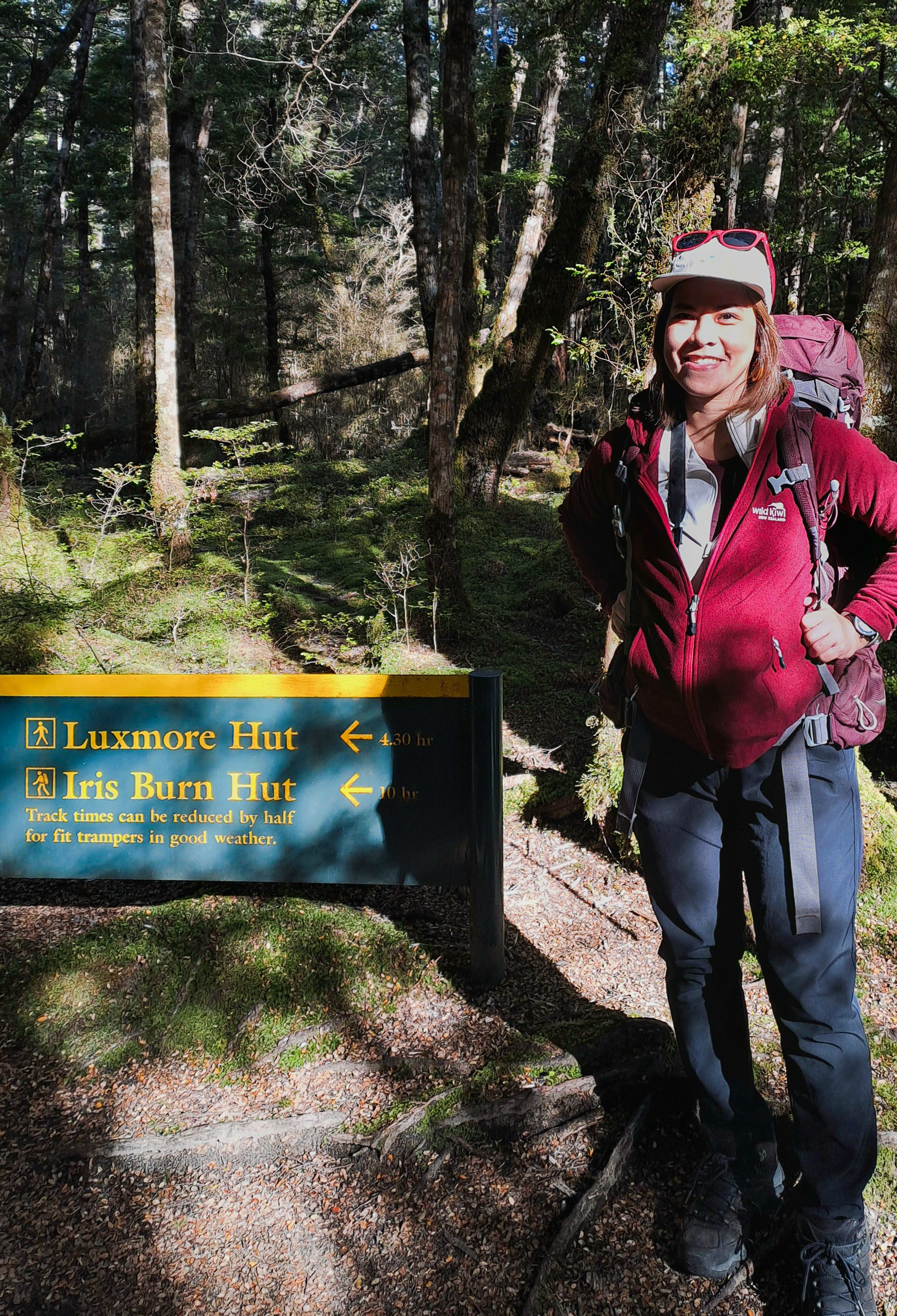
I was travelling to New Zealand for the first time, a country known for its outdoors, surely, I couldn’t let the opportunity pass me by.
Kepler Track: Quick Facts
- Location: Fiordland National Park, starting and ending in Te Anau.
- Distance: 60 kilometres (loop).
- Typical Duration: Three or four days.
- Difficulty: Moderate, featuring a significant alpine ascent to Luxmore Hut.
- Highlights: Limestone bluffs, alpine ridgelines, and moss-draped beech forests.
- Best Time to Hike: The Great Walks season runs between late October and April.
An Impulsive Decision
Many hikers complete the Kepler over four days. I chose to do it in three. I considered myself reasonably fit and assumed I didn’t need the extra day. In truth, I hadn’t planned the hike as carefully as I should have. I hadn’t even intended to hike during this trip. But eventually I thought: I was travelling to New Zealand for the first time, a country known for its outdoors, surely, I couldn’t let the opportunity pass me by.
Luck and Logistics
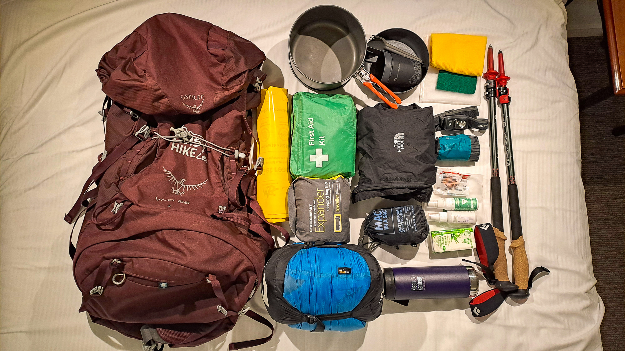
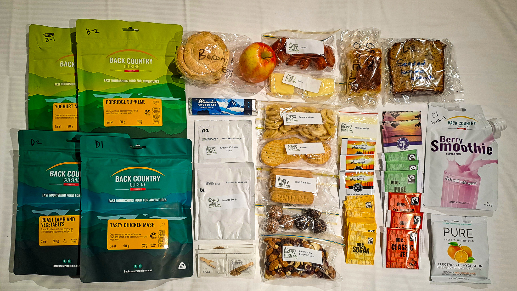
Four months before my trip, I checked availability and found open spots on the Kepler Track. I was really lucky. Milford and Routeburn were tempting alternatives, but they book out quickly and I knew I had already missed my window. The Kepler also offered one practical advantage: it starts and finishes in Te Anau. So, I went ahead and booked my hike. I arranged transfers through a hiking company that organised the boat and bus connections and assembled a gear and food package for me.
I stayed at Bella Vista before the hike. The company delivered my supplies the day before departure. While waiting for check-in time, I registered at the DOC office in Te Anau. When I returned, the motel staff had already kindly moved my luggage and hiking gear into my room.
Most travellers arrive via Queenstown Airport, the closest international gateway to Fiordland. Queenstown receives regular trans-Tasman flights out of major Australian cities and connects easily with long-haul routes arriving into Auckland and Christchurch. Once you land, Te Anau sits roughly 170 kilometres (105 miles) away. You can easily book a scenic two-hour coach ride or hire a car to reach the town, which serves as the perfect base camp before your hike begins.
Once you are there, our Premium Package takes care of the remaining logistics, including:
- Hut Bookings: Secured spots in the Department of Conservation huts.
- Premium Gear: Backpacks, sleeping bags, cooking equipment, and walking poles.
- Food Package: All meals and snacks required for the journey.
- Track Transport: Water taxis, buses, or convenient car relocation.
Day 1 on the Kepler Track: Climbing above the Bushline
I woke up to a clear blue sky. My weather app confirmed that light snow had fallen overnight, which made me feel a little nervous. Snow improves the scenery but complicates the terrain, and I had no experience hiking on snowy tracks.
I applied sunscreen, slung the backpack over my shoulders, and walked to the pier. A water taxi would take us across Lake Te Anau to Brod Bay, where we would begin the hike. The sun climbed steadily, and its warmth slowly calmed my nerves. I told myself it would be a good three days.
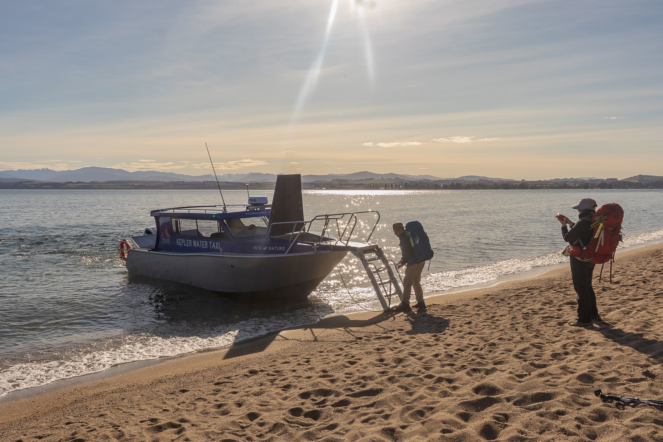
A few hikers had already gathered by the pier, and when the boat arrived, we climbed aboard and crossed the lake. I had never completed a multi-day hike alone. When we stepped onto the shore, I was briefly disorientated. Do I go right or left? Luckily, one of the passengers was a local, and the moment we hit the ground, she moved confidently towards the track, and the rest of us followed.
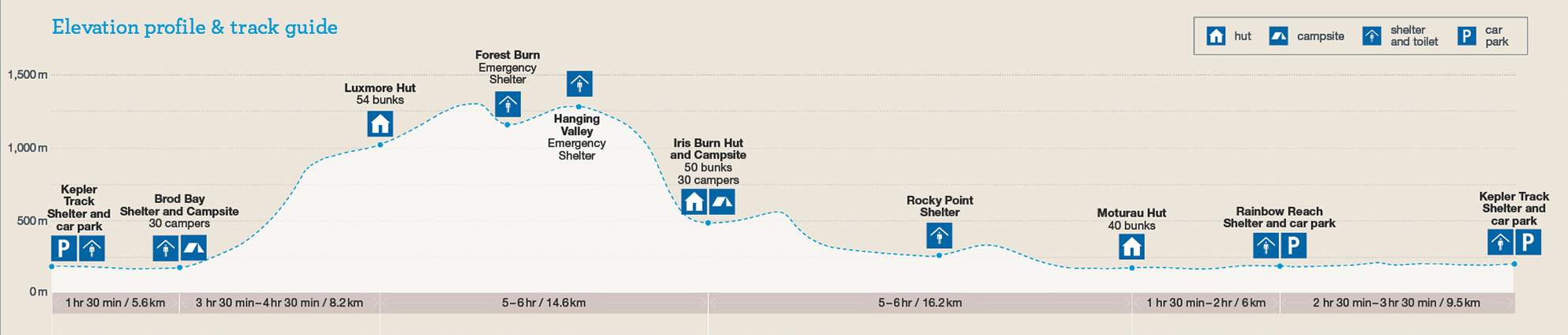
The Kepler Track is a loop and can be hiked in either direction. I chose the counterclockwise route, aiming to reach Luxmore Hut on the first day so I could tackle the steepest climb early. As I set off, I noticed other hikers applying insect repellent. Sandflies have a reputation in New Zealand, so I dug through my pack and coated every exposed patch of skin before starting the climb.
The trail wound through the beech forest before steepening towards the famous limestone bluffs. As the gradient increased, my breathing grew heavier and the pack pressed harder against my shoulders. Regret started creeping in, and I questioned why I hadn’t trained more consistently.
Eventually, I heard wind moving through the trees and knew I was nearing the bushline. I stopped for lunch just below the exposed section. Once I left the shelter of the forest, the wind struck me harder than I expected. The same pack that had burdened me lower down now steadied me against the gusts.
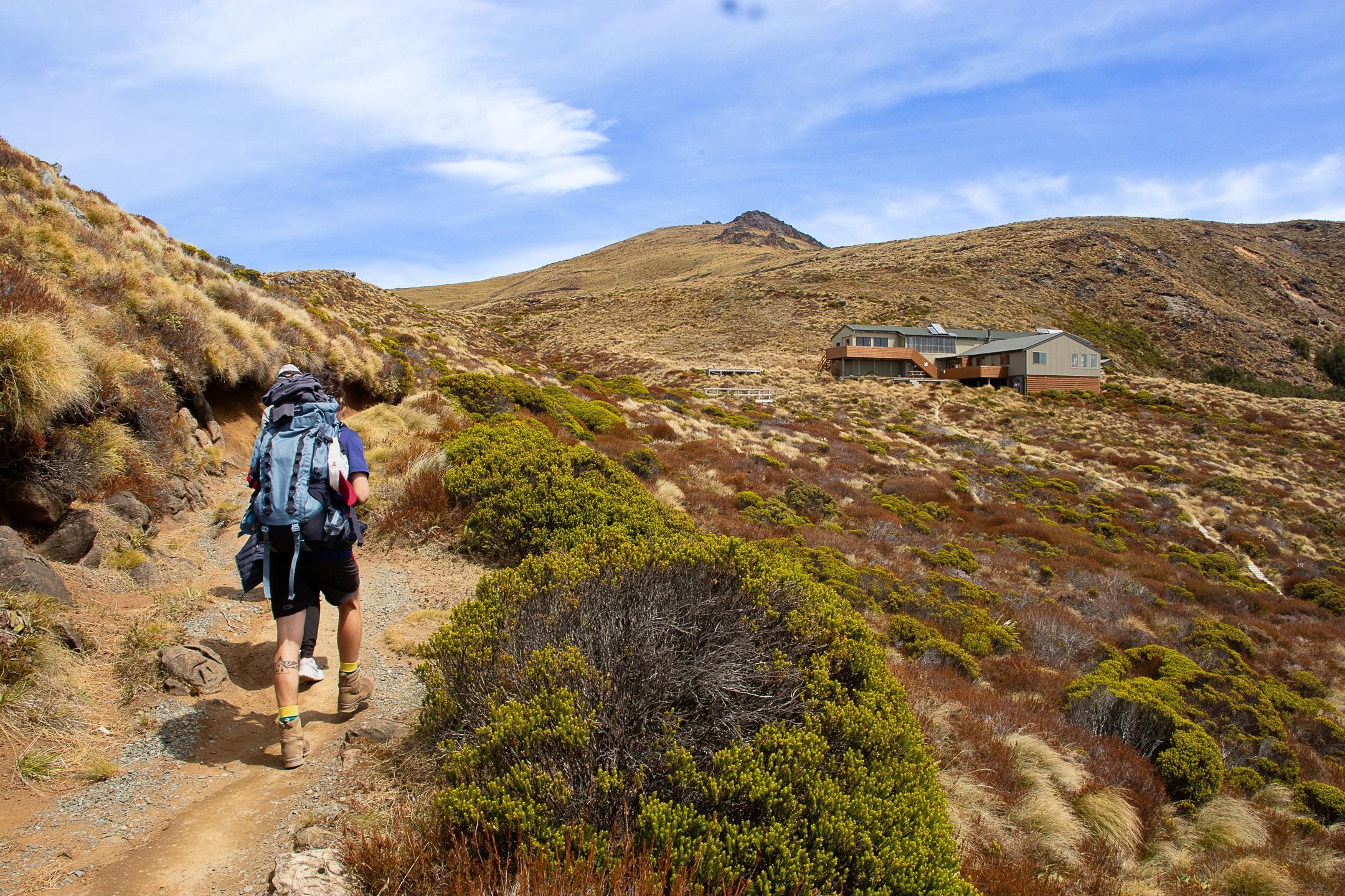
Despite the conditions, I paused to photograph Lake Te Anau, fully visible from that stretch of track. The view up there was breathtaking: not because the ascent left me winded, but because it genuinely was as spectacular as the images on the DOC brochure. Eventually, Luxmore Hut came into view.
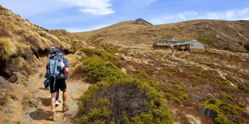
DOC huts allocate beds on a first-come, first-served basis, so faster hikers naturally get to choose better spots. I arrived early in the afternoon and assumed I had made reasonable time, only to discover that most bunks were already occupied. I managed to find a quieter bunk: I sleep lightly, so that mattered. I then explored the hut briefly to get my bearings, and later walked out to see Luxmore Cave before calling it a day.
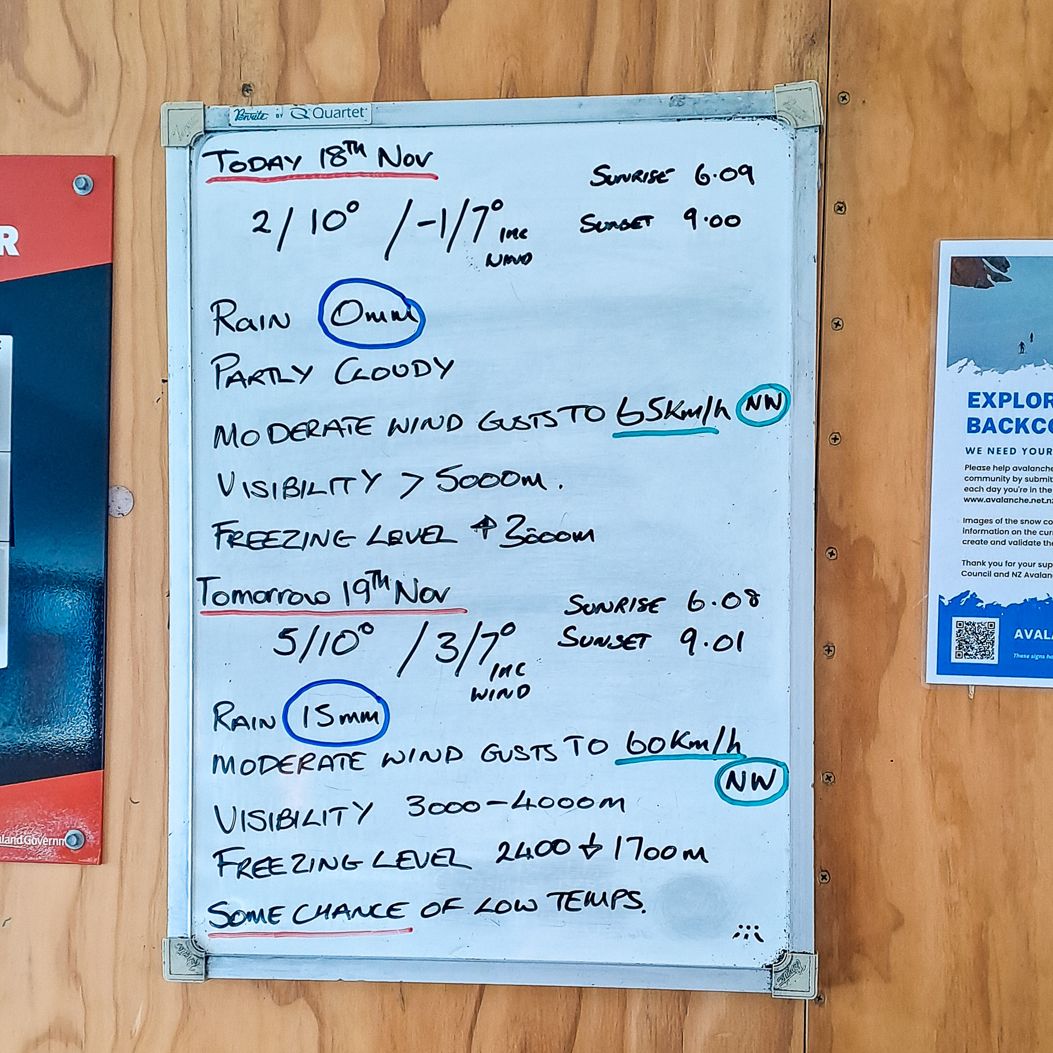
Each hut has a ranger on duty during the Great Walks season. They share information about the environment and deliver the weather forecast each night. I had not researched that aspect of the hut system beforehand, so I went to bed early and missed the briefing. Sometime during the night, I heard voices: low, steady, and almost rhythmic. It wasn’t a dream, was it?


Not Sure Where to Start?
Our experts can organise your transport and gear, just like our Jen did.
Day 2 on the Kepler Track: Ridges, Rain, and Golden Tussock
The ranger had written a wind gust warning on the bulletin board. No snow. I felt relieved, though nothing could have prepared me for what the day would bring. The terrain didn’t worry me, but I knew that more than half the trail lay exposed.
By 7:30 am, I was already on my feet. If the day was going to test me, I wanted as much time on my side as possible. It was cold and drizzling. I scanned the mountains ahead, trying to gauge what was waiting for me; what the weather was going to be like on the ridge. I knew it was impossible to predict anything in the mountains, but I still searched for some sense of control, however false.
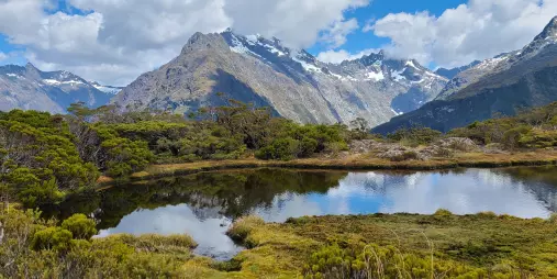
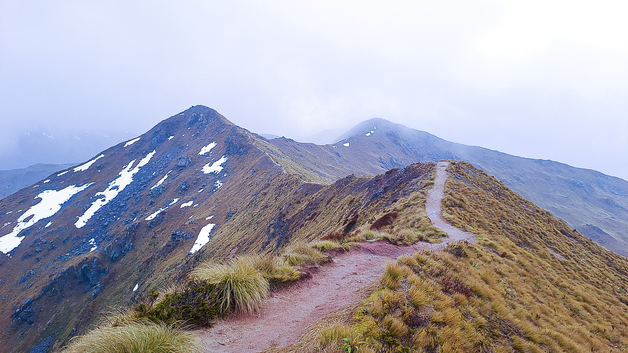
It was spring and all around me, the clouds hung low and the mountain was gold with tussock. It was magical. I moved slowly at first, taking in the landscape and documenting the day despite the cold. I can’t remember when the strong gust came, but it blew in from the east. Below me, the southern fiord of Lake Te Anau funnelled the wind directly up the mountainside. I had forgotten to wear my gloves and by the time I noticed, the wind had already burned my hands raw.
With my hands stinging, I turned my attention to the track. I had to cut across a slope of scree. Luckily, the trail had already angled away from the fiord, and the wind eased momentarily. A couple of hikers caught up with me, and we navigated the narrow path carefully. There was barely space to pass. The visibility was also getting poorer, but at least I didn’t have to worry about the wind for a while.
The mountains looked magnificent, and I felt so small among them.
We reached a junction that led to Mount Luxmore’s summit before we emerged onto the ridge. The wind came back with a vengeance and battered us from both sides. I focused on staying upright and decided against attempting the summit. Even if I reached the top, the clouds would have obstructed any view, so I continued along the main track. Snow lay on either side of the track. It was such a beautiful sight, and under calmer conditions, I would have lingered.
By then, rain had soaked through my outer layer and wind had stripped warmth from my skin. The mountains looked magnificent, and I felt so small among them. Still, all I could think about at that moment was, “Where is the next shelter?”
Around 11:00 am, I finally reached Hanging Valley Shelter. Several hikers were already crowded inside, having a snack. The small space felt humid, but I welcomed the break from the battering outside.
When I stepped back outside, rain eased and a rainbow arched across the valley. I spotted the bushline below and aimed for it. The moment I entered the forest, the world fell quiet. White moss hung from branches and swayed gently, as if ushering me into its world.
From there, the trail descended steadily. I took my time, taking photos of the flora around me, occasionally looking up to admire the moss-covered trees. I passed roaring rivers that drowned out all other sounds.
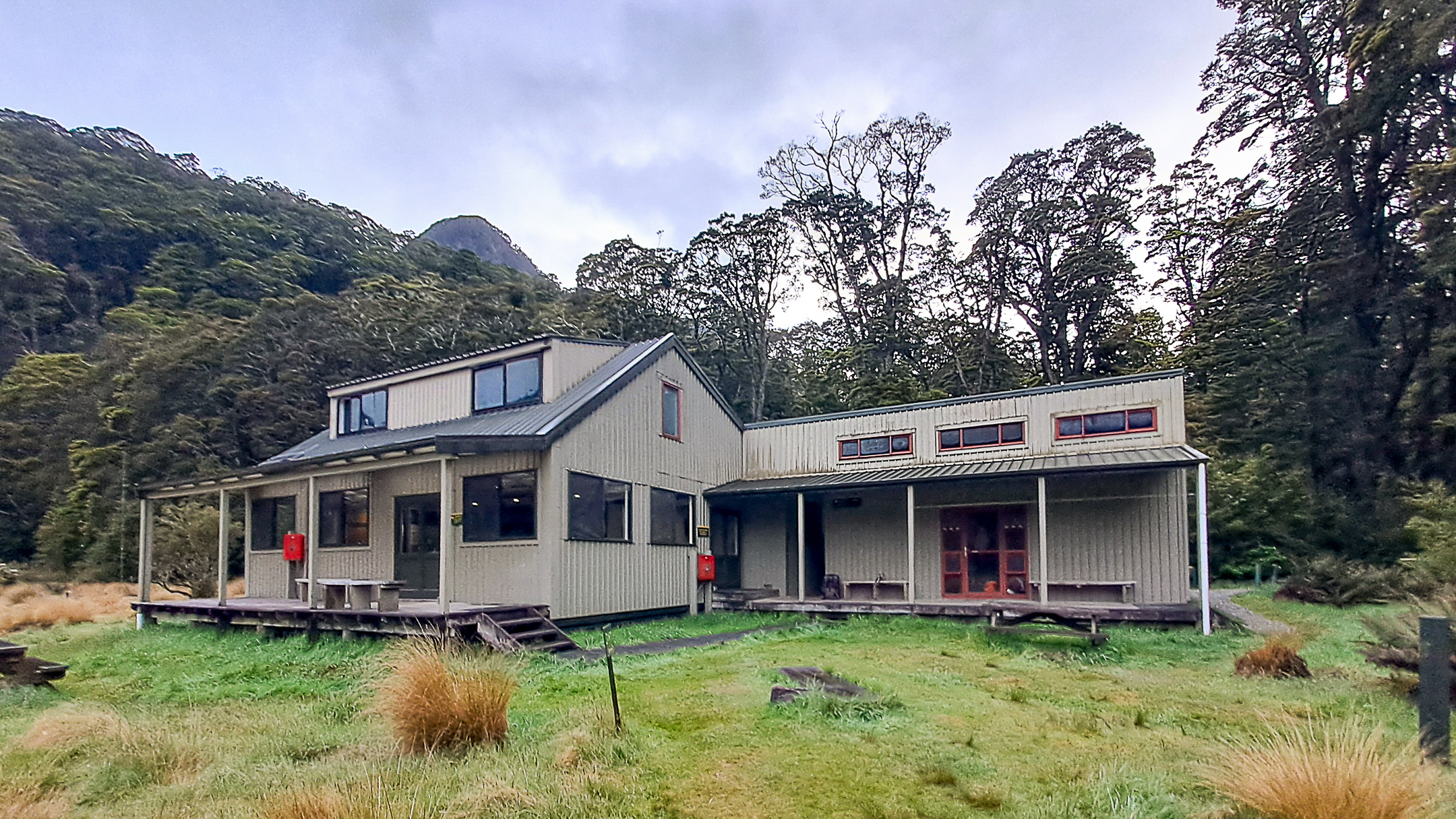
By 1:30 pm, Iris Burn Hut came into view. I had plenty of time in the afternoon to explore the area, but it kept raining and I really just wanted to get out of my wet clothes. The hut was smaller, and by evening, the common area had turned into a boiling, overcrowded room. Finding a seat was difficult, and staying outside meant getting swarmed by sandflies. I ate my dinner as quickly as I could and retreated to my bunk.
I struck up a conversation with my roommate. She had originally planned to camp, but she was warned that the kea had grown particularly destructive that season. She had just bought her tent and chose not to risk it. I had always wanted to see a kea in the wild, though preferably not while it’s trying to destroy my gear.


Day 3 on the Kepler Track: 22 Kilometres to the Finish
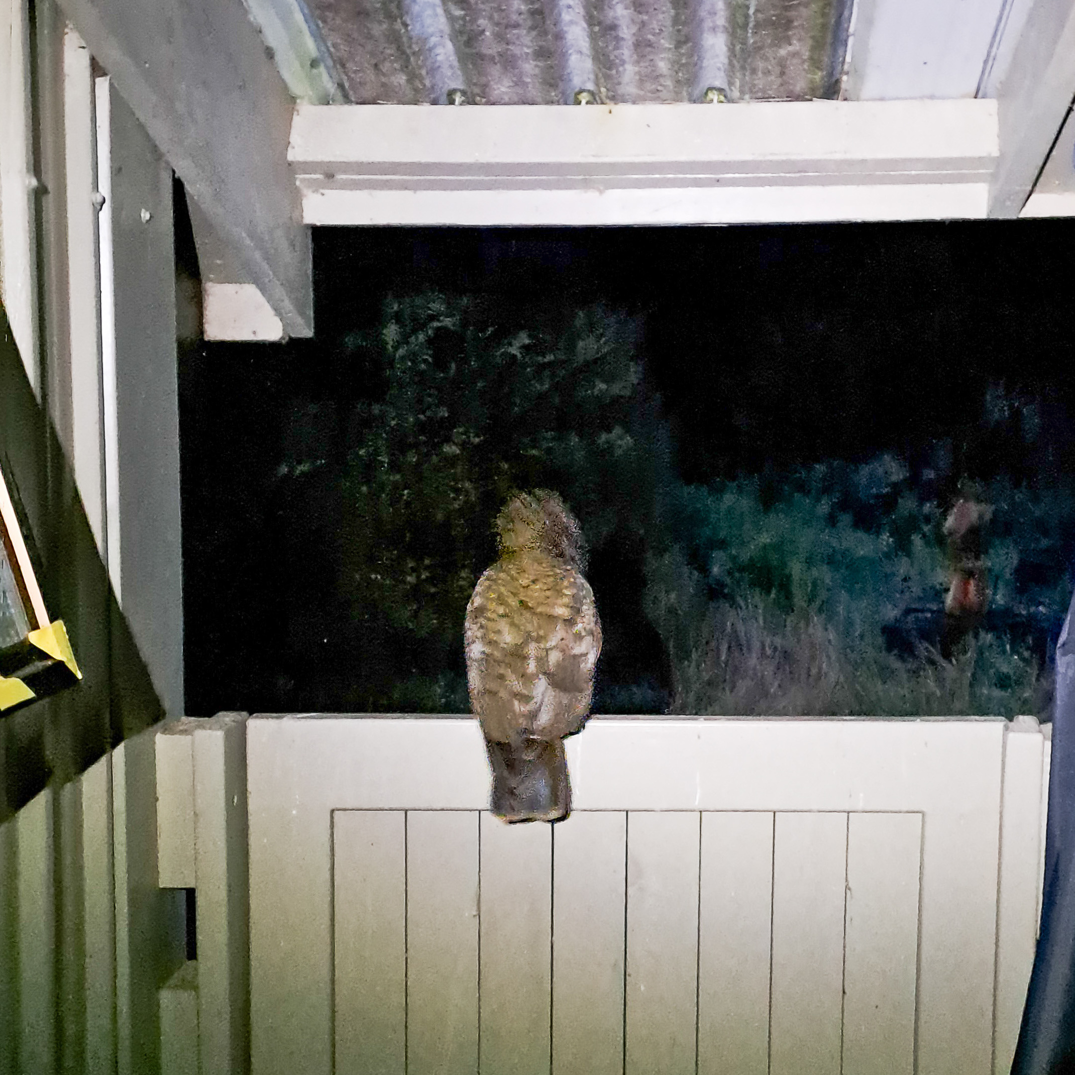
The warnings proved accurate because the next morning, I caught a kea attempting to extract my electrolyte tablets from the side pocket of my backpack. It tilted its head at me, unimpressed, hopping away as if to suggest this was only the beginning. Or did I imagine all of that?
Dawn had barely broken. I had a bus to catch in the afternoon and 22 kilometres of track to cover, so I quietly packed my gear, ate a quick breakfast, and stepped back onto the trail.
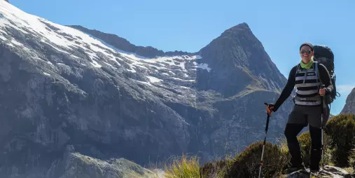
I walked alone for hours. Normally, as a female traveller, I would feel some degree of anxiety in a remote place like this. But this place felt different. I moved at my own pace and stopped whenever I wanted. The solitude felt liberating rather than threatening.
After about three hours, I reached Rocky Point Shelter, and the moment I stopped walking, the sandflies descended on me, as if they were waiting all night for a warm body to appear. They swarmed my hands and neck, drawn even to my dark clothing. I abandoned the idea of a proper break and continued. The forest stretched for miles. My feet throbbed and my shoulder felt sore. I heard occasional footsteps behind me but rarely saw anyone.
The solitude felt liberating rather than threatening.
When I reached Moturau Hut, I knew I was getting close. It sat beside the lake, with open views across Lake Manapouri. The clouds parted briefly, and I saw birds coming out to hunt for food. I sat at a picnic table, ate lunch, and let my feet rest.
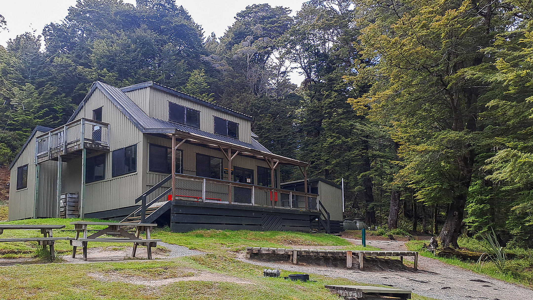
I was only about an hour away from finishing my hike. By then, more walkers appeared on the track, mostly day hikers, fresh and lightly packed. The forest began to thin, and I could hear car engines in the distance.
By this point, my feet had disappeared from beneath me. The boots that had served me for years now felt unforgiving after three consecutive days.
Then, at last, the Rainbow Reach bridge came into view, signalling the end of the Kepler Track. I crossed it slowly, partly because my feet really, really hurt and partly because I didn’t want the moment to pass too quickly. When I reached the car park on the other side of the bridge, I lowered my pack onto a park bench, removed my boots, and let my feet breathe for the first time in hours.
While waiting for my shuttle, I sat there and thought about the past three days. I could have taken four days. I could have trained harder.
I knew I hadn’t done it perfectly, but I had done it. And despite their best efforts, the kea hadn’t managed to claim any souvenirs.


About The Author
Jen is a travel and outdoors enthusiast. She enjoys running, hiking, and occasionally taking her friends out on a road trip. She has trekked to the Everest Base Camp in Nepal, Mt Kinabalu in Sabah, and Jade Mountain in Taiwan. She works as a Product Manager in Go New Zealand.
Planning your own Kepler Track walk?
We can help with transport, gear, accommodation, and pre- or post-hike stays in Te Anau.